0427 110 025
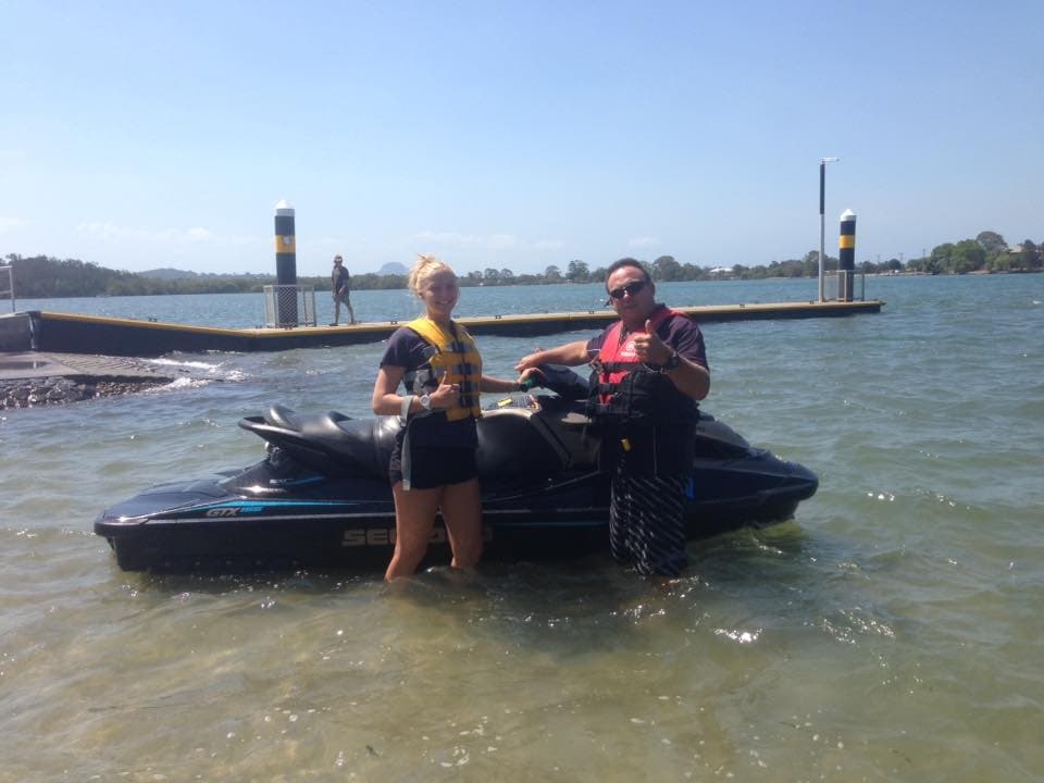
A Sea-Doo jet ski on the Maroochy River at Maroochydore
Get Licensed.

Boat Licence in Nambour

Petrie Creek runs through Nambour into the Maroochy system, and MSQ treats it as navigable to 12 metres only as far as the Diddillibah road bridge. Courses run at our Maroochydore venue on the Maroochy River.

Nambour locals

Boat Licence near Nambour

A couple with the ABC Boating training boat after passing the Queensland boat licence, the course Nambour students travel to the Maroochydore base to complete

Nambour has its own creek. Petrie Creek runs through the town and joins the Maroochy system downstream. Maritime Safety Queensland treats it as navigable by shallow-draught vessels up to 12 metres, but only as far as the David Low Way road bridge at Diddillibah, which carries about three metres of clearance at the highest tide. The one launch point on Nambour's own creek is informal, off Petrie Creek Road at Diddillibah, and it appears in neither the council ramp register nor the MSQ facilities database.

Nambour is a creek town, and the creek has a ceiling written into it. Maritime Safety Queensland records Petrie Creek as navigable by shallow-draught ships up to 12 metres, but only as far as the David Low Way road bridge at Diddillibah, where the clearance is about three metres at the highest astronomical tide. Above the Paynter Creek junction the creek meanders at 90 degrees or less and becomes very narrow and shallow, under 10 metres wide just downstream of the Bruce Highway at Rosemount. That is real water with a real size limit, and it is worth knowing which boat fits it before you buy one.

Start with where a trailer boat actually goes in. The only launch point on Nambour's own creek is an informal ramp off Petrie Creek Road at Diddillibah, and MSQ records that it appears in neither the council ramp register nor the MSQ boating facilities database. An unrecorded ramp carries no published lane count, no tide flag and no parking detail, so nothing about it can be looked up before you arrive.

The ramps that are recorded sit on the Maroochy itself. Muller Park at Bli Bli, MSQ identifier MA21, is the closest recorded Maroochy River trailer ramp to the northern hinterland, and MSQ flags it Low Tide Restricted; the Cod Hole on Bradman Avenue, MA11, and Fishermans Road, MA14, are not flagged that way. That single field is the difference between a launch that works at any tide and one that does not, and it is public.

There is one rule on your own creek that almost nobody hears about. Water skiing is prohibited on Petrie Creek, gazetted 28 February 1997. It is not a coastal rule or a general one, it applies to the water running through Nambour.

The size ceilings change again once you are out on the river. MSQ puts 2.8 metres of clearance under the David Low Bridge at highest astronomical tide, and because of that the reach above the bridge is navigable only by powered vessels up to seven metres, while below the bridge the limit is twelve. Petrie Creek's own twelve metre figure applies only as far as Diddillibah. One river system, several different ceilings, depending on which reach you are in.

On the course day this stops being trivia. Operating at 6 knots or less is one of the tasks you are assessed on, and reading which limit applies to the water under you is the skill that sits behind it. You do the online theory first, then book your on-water day, and the theory has to fall no more than three months before it. The day runs at our Maroochydore venue on the Maroochy River, the system Petrie Creek drains into, with the run down along the Nambour Connection Road and David Low Way.

The course itself is the same wherever you sit it: the theory online first, in your own time, then a day on the water with a trainer before the assessment. You need a licence for any boat with an engine over 4.5 kilowatts, which is nearly every tinny, runabout and cruiser. Pass, and the Queensland licence never expires. Pick the date that suits you and book online.
What's involved

Your course, step by step

Planning to launch on Petrie Creek because it runs through town

Nambour has a creek at its centre, and MSQ does record Petrie Creek as navigable water joining the Maroochy system. Assuming there is a ramp on it is a reasonable guess.

The only launch point on Nambour's own creek is an informal ramp off Petrie Creek Road at Diddillibah, and it is in neither the council ramp register nor the MSQ boating facilities database. Nothing about it is published, so there is no tide flag, lane count or parking detail to check before you tow a boat there.

We point Nambour readers at the recorded ramps on the Maroochy instead, where the details are public, and the client publishes its own launching and retrieving guide covering ramp drop-offs, tide timing and walking an unfamiliar ramp first.

Buying a boat that will not fit the creek it is meant for

Petrie Creek reads on a map as a proper waterway running from Nambour to the river, so people size the boat to the trip rather than to the reach.

MSQ treats the creek as navigable by shallow-draught ships up to 12 metres, and only as far as the David Low Way road bridge at Diddillibah, whose clearance is about three metres at the highest astronomical tide. The clearance, not the length, is what stops most boats.

The theory covers preparing a vessel for the water it will be operated on, and the on-water day is a good place to ask a trainer about the boat you actually own.

Expecting the upstream creek to open out

Most creeks feel like they get easier the further you go. Petrie Creek does the opposite above the Paynter Creek confluence.

MSQ records that above that junction the creek meanders at 90 degrees or less and becomes very narrow and shallow, under 10 metres wide just downstream of the Bruce Highway at Rosemount. Turns that tight, in water that shallow, are where a new skipper gets caught out.

Port and starboard turns and a figure 8 manoeuvre, on and off the plane, are mandated parts of the practical assessment, so slow-speed boat handling is trained before you meet a bend like that.

Assuming you can ski on your local creek

Water skiing rules vary reach by reach and the prohibition on Petrie Creek is old enough that few people have heard of it.

Water skiing is prohibited on Petrie Creek, gazetted 28 February 1997. It is a standing rule on Nambour's own water, not a seasonal or coastal one.

The course covers applying state and international regulations as a mandated unit, and the honest habit it builds is checking the gazetted rules for the reach you are on rather than the river as a whole.

Picking a Maroochy ramp without checking the tide flag

Because Nambour's own creek launch is informal and unrecorded, the practical options are the recorded ramps downstream, and they look interchangeable on a map.

They are not. Muller Park at Bli Bli, MA21, is the closest recorded Maroochy River trailer ramp to the northern hinterland and MSQ flags it Low Tide Restricted, while the Cod Hole on Bradman Avenue, MA11, and Fishermans Road, MA14, are not. Turning up at the wrong one on a low tide costs you the trip.

We name the flag rather than the ramp, because the flag is the part that changes your day. The client's ramp guide adds the practical half: time your retrieval for a risen tide if the ramp drops off at low water.

Local, qualified, trusted

BoatSafe approved, backed by ABC Boating

The venue closest to Nambour is checkable in the same way. The Queensland Government's BoatSafe register lists Australian Boating College at Maroochydore, on the Maroochy River that Petrie Creek runs into, under the phone number on this site. Jason Bowring, writing after his day: 'Amazing service. Instructor was super thorough and explained everything easily. Course structure is great. Highly recommended'. In Queensland a marine licence can only come from an approved BoatSafe provider, so that listing is the one that counts. The training organisation behind the courses, Australian Boating College, is current on the national training register. Every approved provider works to the same floor: trainers hold a commercial marine qualification and pass a criminal history check, the training vessel is commercially certified and carries sun protection, and the organisation running it has to carry public liability cover of at least 20 million dollars. Maritime Safety Queensland audits providers and can suspend one that cuts corners.

  • BoatSafe Approved

    Approved by Maritime Safety Queensland to deliver the BoatSafe recreational marine and PWC licence courses.

    Verify
  • Nationally Accredited Training

    Courses are delivered under the registration of Australian Boating College, RTO #3399, so the training is nationally accredited.

    Verify
  • Backed by ABC Boating

    Part of the Australian Boating College network, which delivers boat and PWC licence training across Australia.

    Verify
  • 5-Star Rated on Google

    Rated 5 stars on Google by students across the Sunshine Coast. Read the reviews on our Google profile.

    Verify
Getting here

From Nambour to our Maroochydore base

From Nambour, near the Nambour town centre and Petrie Creek, it is along the Nambour Connection Road and David Low Way to the Maroochy River base at Maroochydore. Nambour sits inland on Petrie Creek in the hinterland, and the on-water training runs on the sheltered Maroochy River at Maroochydore. We run the boat licence there with all equipment provided, so Nambour locals can get licensed close to home.

Where we train:
Apex Park, 107 Fishermans Road, Maroochydore QLD 4558
View Maroochydore Dates
Quick enquiry

Enquire about the Boat Licence

Tell us the date that suits you near Nambour and our team will come back to you, usually within one business day. Prefer to talk it through? Give us a call.

  • We reply within one business day
  • Friendly, no-obligation advice
  • Caloundra, Maroochydore & Noosa
Prefer to call?0427 110 025

Seven days for bookings and enquiries

No obligation. We only use your details to reply to this enquiry.

Good to know

Boat Licence in Nambour: FAQs

Can I launch a boat on Petrie Creek at Nambour?

There is one launch point on Nambour's own creek and it is informal: a ramp off Petrie Creek Road at Diddillibah that appears in neither the council ramp register nor the MSQ boating facilities database. Because it is unrecorded, no lane count, tide flag or parking detail is published for it. The recorded trailer ramps for this area sit on the Maroochy River itself.

How big a boat can go up Petrie Creek?

Maritime Safety Queensland treats Petrie Creek as navigable by shallow-draught ships up to 12 metres, but only as far as the David Low Way road bridge at Diddillibah. That bridge carries about three metres of clearance at the highest astronomical tide, so the height of your boat matters more than its length. Above the Paynter Creek junction the creek narrows sharply.

Is water skiing allowed on Petrie Creek?

No. Water skiing is prohibited on Petrie Creek, gazetted 28 February 1997. It is a standing prohibition on Nambour's own water rather than a seasonal restriction. Rules like this sit reach by reach across the Maroochy system, which is why the course covers applying state and international regulations as one of its mandated units.

Which Maroochy River ramp should I use from Nambour?

Check the tide flag before you decide. Muller Park at Bli Bli, MSQ identifier MA21, is the closest recorded Maroochy River trailer ramp to the northern hinterland suburbs, and MSQ flags it Low Tide Restricted. The Cod Hole on Bradman Avenue, MA11, and Fishermans Road, MA14, are not flagged that way. All three are searchable in the MSQ boating facilities database.

Does the same size limit apply once I am out on the river?

No, it changes by reach. The David Low Bridge has 2.8 metres clearance at highest astronomical tide, and MSQ states that because of it the reach above the bridge is navigable only by powered vessels up to seven metres, while below the bridge the limit is twelve. Petrie Creek's own twelve metre figure runs only as far as Diddillibah.

Where does the course actually run from Nambour?

At our Maroochydore venue on the Maroochy River, the system Petrie Creek drains into, reached along the Nambour Connection Road and David Low Way. The Queensland Government's BoatSafe register lists Australian Boating College at Maroochydore under the phone number on this site. You complete the online theory at home first, no more than three months before your practical day.

Do I need a boat licence in Queensland?

Yes, if your boat has an engine of more than 4.5 kilowatts (around 6 horsepower), which covers almost every powered recreational boat. You can operate without a licence if someone who holds a valid marine licence is supervising you on board. Our one-day BoatSafe course covers what you need, and once issued the licence is yours for life.

How long is the course?

One day on the water. You complete the online theory beforehand, then spend a hands-on day on sheltered Sunshine Coast water at Caloundra, Maroochydore or Noosa. You sit the assessment the same day, and once you pass you leave with the BoatSafe certificate you need to apply for a Queensland licence. If you need more time on the water to feel competent, we would rather you took it.

Which location should I choose: Caloundra, Maroochydore or Noosa?

Pick whichever is most convenient, since the course and the qualification are identical at all three. Caloundra trains on the sheltered Pumicestone Passage, Maroochydore on the sheltered Maroochy River, and Noosa on the Noosa River. You can view dates for every location on our Course Dates page and book the one that suits you.

Close by

We Also Train Nearby

More courses

Other Licences We Offer

Get your boat licence near Nambour

Nambour's own creek has no registered ramp, so your trailer meets the Maroochy further down.

Book Your Course Today Call 0427 110 025