Boating the Pumicestone Passage: speed limits, marine park zones, shallows and tides
Updated 12 min read
The short answer
The Pumicestone Passage is a 35 kilometre tidal channel between Bribie Island and the mainland, running from Caloundra south to Deception Bay. It sits inside the Ramsar-listed Moreton Bay Marine Park, and about 80% of it is less than 2 metres deep. Since 9 January 2026 the Caloundra end has had fixed speed limits: 6 knots in a strip about 100 metres off the mainland shore, and 20 knots across the rest of that northern stretch. Add marine park zones, two go slow areas and a tide that pushes in from both ends, and it's water that rewards some homework. Here's what the official sources say.
What and where: a 35 km tidal passage between Bribie Island and the mainland
The Pumicestone Passage is the narrow, shallow water that separates Bribie Island from the mainland. City of Moreton Bay puts its length at 35 kilometres, from the tip of Bribie Island near Caloundra to Deception Bay. Sunshine Coast Council describes it as a long tidal waterway, flushed from two mouths: Caloundra in the north and Deception Bay in the south.
Queensland's WetlandInfo calls it one of the few barrier estuaries in Australia. Creeks such as Bells, Coochin, Tibrogargan and Elimbah drain east off the D'Aguilar Range and the Glass House Mountains into it. Council also calls it a regional aquatic playground, used for boating, paddling, fishing and swimming.
For safety gear, the Passage counts as smooth waters. Schedule 8 of the Transport Operations (Marine Safety) Regulation 2016 lists the waters between the mainland and the western shore of Bribie Island, up to its northern tip. Our life jacket rules guide covers what that means for lifejackets.
This guide stays inside the Passage. Its northern entrance includes Bribie Island Bar, a designated coastal bar, which is a separate topic.
Speed limits: 6 knots off the Caloundra shore, 20 knots across the northern Passage
Maritime Safety Queensland gazetted two fixed speed limits for the northern Pumicestone Passage on 9 January 2026. Both apply to every vessel.
The first is 6 knots in a strip roughly 100 metres wide off the mainland. It runs from the northern bank at Caloundra, south past Golden Beach, to the shore beside Military Jetty. The second is 20 knots across the rest of that northern stretch, from the edge of the 6 knot strip over to Bribie Island, down to about the latitude of Military Jetty.
Part of Bells Creek, which feeds the Passage at Caloundra, got its own 6 knot limit on the same day.
These boundaries are set by coordinates, so you can't judge them by eye from the water. Check map S8sp-92-3 for the Passage and S8sp-91-2 for Bells Creek on MSQ's schedule of speed limits before you go. MSQ last updated that schedule on 11 September 2026, and it can add, change or remove fixed limits, including temporary ones.
Distance-off rules: 6 knots within 30 metres, or 60 metres on a jet ski
The state-wide distance-off rules apply across the whole Passage, the 20 knot zone included. They only switch off where a fixed limit of 6 knots or less already applies. So even in the 20 knot zone, you're back to 6 knots near people, moored boats and jetties. Beyond the Caloundra zones, MSQ's schedule lists no other Pumicestone Passage limit. Check the schedule anyway, because it changes.
Under section 81 of the regulation, a boat must not go faster than 6 knots within 30 metres of a person in the water, a boat that's anchored, moored, tied to the shore or aground, or a jetty, wharf, boat ramp or pontoon. The maximum penalty is 200 penalty units.
Jet skis get a wider buffer. Section 82 sets 6 knots within 60 metres of those same things, plus the shore and the boundary of a bathing reserve. It also sets 10 knots within 30 metres of another moving boat.
On a narrow channel this popular, those distances come up often. Our Queensland boating rules guide and jet ski rules guide cover the exceptions. Marine park go slow areas, below, sit on top of all of it.
Marine park zones: the Passage sits inside Moreton Bay Marine Park
The Pumicestone Passage is part of the Moreton Bay Marine Park, so the Marine Parks (Moreton Bay) Zoning Plan 2019 applies on top of the boating rules. The plan divides the park into zones, and several are named for the Passage or for Bribie Island's shores.
Marine national park zones are the most protected. In the Passage they're MNP01 Westaways Creek and MNP02 Tripcony Bight-Long Island. Fishing and collecting aren't allowed there. You can still travel through by boat, as long as any fishing gear is stowed or secured.
Conservation park zones CPZ01 Pumicestone Channel (north) and CPZ02 Pumicestone Channel-Godwin Beach allow limited line fishing. That's no more than 2 rods or handlines and 2 hooks in total per person. Limited crabbing means no more than 4 pots, dillies or collapsible traps.
Habitat protection and general use zones allow more. The table below sums up each zone, and the official zoning maps show where the lines fall.
Go slow areas: come off the plane at Westaways Creek and Tripcony Bight
The zoning plan names two go slow areas for natural values in the Passage: GSN01 Westaways Creek, at the northern end of Bribie Island, and GSN02 Tripcony Bight-Long Island. Inside them, section 33 says you must not run a vessel in planing or non-displacement mode, or use it for a motorised water sport. The maximum penalty is 10 penalty units.
Planing means the hull travels over the top of the water. So drop off the plane and let the hull sit in it.
Motorised water sport is wider than you might think. It includes towing a skier or tube, weaving, circling or jumping wash. On a jet ski, it covers any riding other than transport by the most direct reasonable route between 2 places.
There's one exception. In GSN02, the rule doesn't apply in a navigation channel marked by aids to navigation.
The plan says these areas protect relatively undisturbed parts of the park and give people a chance to appreciate them. Check the zoning map for the boundaries before you head down the Passage.
Shallows: about 80% of the Passage is less than 2 metres deep
Sunshine Coast Council says about 80% of the Pumicestone Passage is less than 2 metres deep. Add intertidal flats and sand islands, and water that looks open at high tide can be sand or mud at low tide.
The BoatSafe Workbook's shallow-water advice fits the Passage well. Get to know the area at low tide, when it's easier to see where the navigable water is. Ask experienced boaties what shallow water looks like: ripples on the surface, surface patterns that change suddenly, or a different water colour. Wear polarised sunglasses, which highlight shallow areas, and use a chart and an echo sounder to read depths.
On a jet ski, the Workbook says to reduce speed significantly in shallow water.
Running aground costs more than a damaged prop. The Workbook warns that propellers can damage seagrass, so don't drive across shallow, weedy areas. WetlandInfo notes that the Passage's seagrass meadows and flats are habitat for fish, dugong, turtles, crabs and juvenile prawns.
Tides: the Passage fills and drains from both ends
The tide flushes the Pumicestone Passage from both mouths, Caloundra in the north and Deception Bay in the south, according to Sunshine Coast Council. The two tides meet partway down.
WetlandInfo puts that meeting point at the lower end of Tibrogargan Creek, also known as Hussey Creek, where there's almost no water movement from tidal action. Tripcony Bight, a wide estuary area beside it, formed because the water there has so little energy. So if you've wondered where the waters meet in the Passage, that's the official answer.
For trip planning, use the official predictions. Maritime Safety Queensland publishes the Queensland Tide Tables free online, with predictions for standard ports and instructions for working out tides at other locations. The BoatSafe Workbook explains how. For a secondary place, you apply the corrections listed in the back of the tables to a nearby standard port.
On a channel this shallow, the tide decides where you can go, so check it before you leave and keep an eye on it while you're out.
Wildlife: dugong, turtles, seagrass and migratory shorebirds
Sunshine Coast Council lists seagrass meadows, sand islands, intertidal flats and mangroves among the Passage's values, along with turtles, dugong and migratory shorebirds. It's also a declared fish habitat area under state legislation. City of Moreton Bay calls it one of the most important bird and marine habitats on the east coast of Australia.
That should change how you drive. The BoatSafe Workbook says that in marine park areas set aside for animals such as turtles and dugong, you should go slow in a non-planing mode, keep a good lookout and drive so you avoid hitting them. Stay off shallow, weedy areas, because propellers can damage seagrass.
On a jet ski, the Workbook adds two more. Avoid shallow areas where wading birds gather and roost, and try to ride where your noise won't disturb other people or wildlife.
The go slow areas make some of this law. Everywhere else in the Passage, it's just good boating.
Learning to boat on the Passage from our Caloundra venue
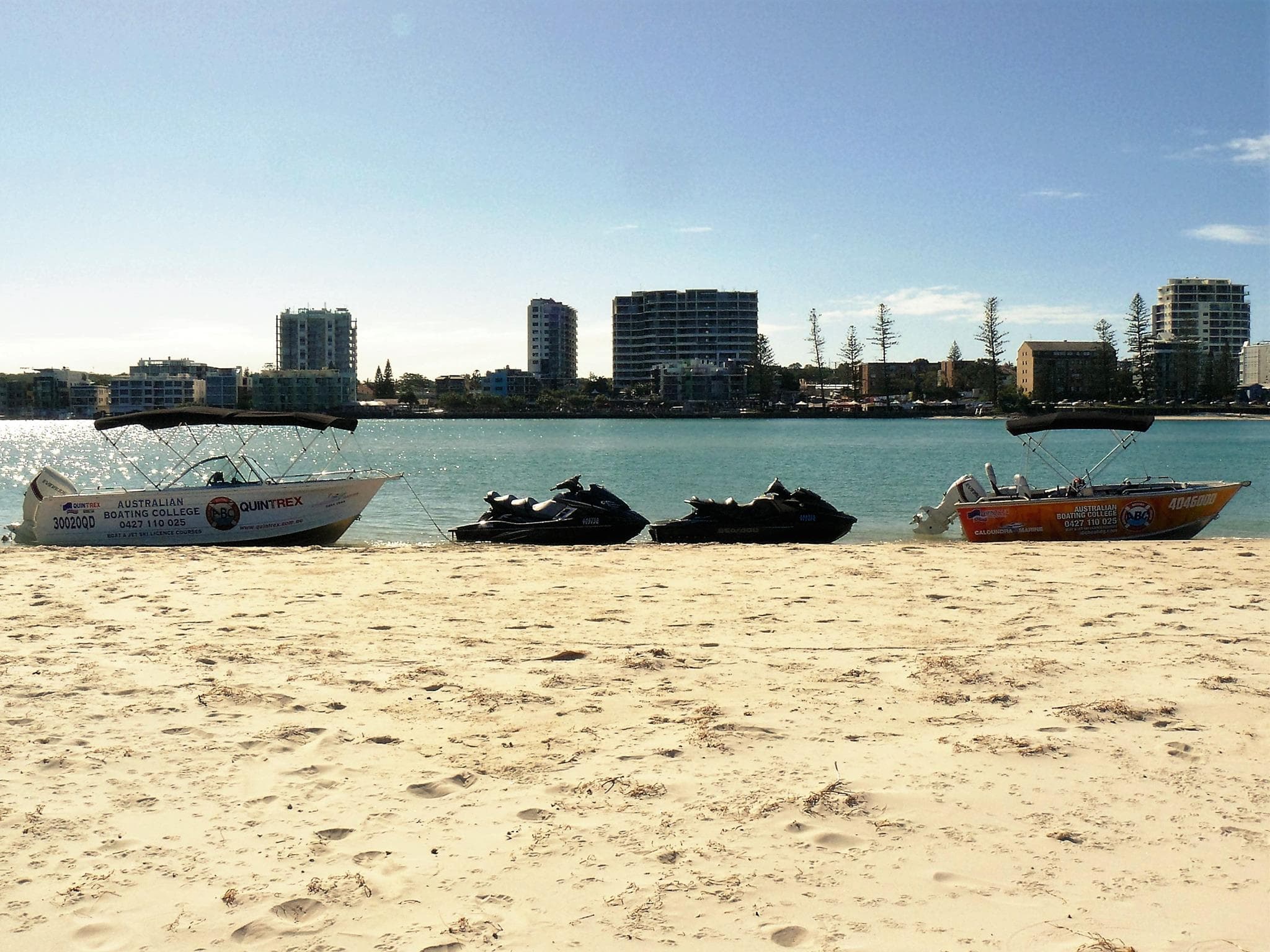
Our Caloundra course venue is at Golden Beach, on the Pumicestone Passage, so a Boat Licence course there puts you on the water this guide describes. The Boat Licence course is priced from $329, with online theory included and all equipment provided. If you'd like to ride a jet ski as well, the Boat & Jet Ski Combo covers both licence courses in a single day.
Your instructor flags what's current on the Caloundra water during the course, including the speed zones. Reading depth and tide gets real practice on water this shallow.
Want to know more about the venue first? See our Caloundra page, or pick a date on the course dates page. Not sure you need a licence at all? Start with do I need a boat licence in Queensland?
Training delivered by Australian Boating College, RTO #3399.
Moreton Bay Marine Park zones and areas named in and around the Pumicestone Passage (Marine Parks (Moreton Bay) Zoning Plan 2019)
Scroll sideways to see every column
| Zone or area | Named areas | What it means for boaters |
|---|---|---|
| Marine national park zone | MNP01 Westaways Creek; MNP02 Tripcony Bight-Long Island | No fishing or collecting. You can travel through with fishing gear stowed or secured. |
| Go slow area for natural values | GSN01 Westaways Creek; GSN02 Tripcony Bight-Long Island | No planing and no motorised water sport, including towing. Marked navigation channels in GSN02 are exempt. Maximum 10 penalty units. |
| Conservation park zone | CPZ01 Pumicestone Channel (north); CPZ02 Pumicestone Channel-Godwin Beach | Limited line fishing (2 rods or handlines, 2 hooks per person) and limited crabbing (up to 4 pots, dillies or traps). |
| Habitat protection zone | HPZ01 Bribie Island (north); HPZ04 Bribie Island (west) | Line fishing, crabbing, netting and trolling without a permit. Trawling isn't on the list. |
| General use zone | GUZ01 Bulcock Beach; GUZ03 to GUZ05 Elimbah Creek | The widest range of fishing, including trawling. |
| Fixed speed limits (MSQ, gazetted 9 January 2026) | Pumicestone Passage at Caloundra; Bells Creek | 6 knots within about 100 metres of the mainland shore and on part of Bells Creek; 20 knots across the rest of the northern Passage. |
Common questions
What is Pumicestone Passage?
It's the tidal waterway between Bribie Island and the mainland, about 35 kilometres long from the tip of Bribie Island near Caloundra to Deception Bay. WetlandInfo describes it as one of the few barrier estuaries in Australia. It's part of the Ramsar-listed Moreton Bay Marine Park and a declared fish habitat area, so marine park zoning applies alongside the usual Queensland boating rules.
How deep is the Pumicestone Passage?
Mostly shallow. Sunshine Coast Council says about 80% of the Passage is less than 2 metres deep, with intertidal flats and sand islands that change what's navigable as the tide moves. Use a chart and an echo sounder, check the Queensland Tide Tables before you go, and wear polarised sunglasses to help spot the shallows, as the BoatSafe Workbook suggests.
What is the speed limit in the Pumicestone Passage?
At the Caloundra end, MSQ gazetted two limits on 9 January 2026: 6 knots in a strip about 100 metres off the mainland shore from Caloundra to Military Jetty, and 20 knots across the rest of that northern stretch. Throughout the Passage, including the 20 knot zone, the distance-off rules apply: 6 knots within 30 metres of people, moored boats and jetties, or 60 metres for jet skis. Go slow areas mean no planing.
Can you fish in the marine national park zones of the Pumicestone Passage?
No. The Passage's marine national park zones, MNP01 Westaways Creek and MNP02 Tripcony Bight-Long Island, don't allow fishing or collecting. You can still travel through by boat if your fishing gear is stowed or secured. The conservation park zones in the Passage allow limited line fishing, with no more than 2 rods or handlines and 2 hooks per person.
Where do the waters meet in the Pumicestone Passage?
Near the lower end of Tibrogargan Creek, also known as Hussey Creek, according to Queensland's WetlandInfo. The Passage is flushed by the tide from both Caloundra and Deception Bay, and where the two tides meet there's almost no tidal water movement. Tripcony Bight, the wide estuary area beside it, formed because of that low energy water.
Can you ride a jet ski in the Pumicestone Passage?
Yes, within the rules. The 6 and 20 knot zones at Caloundra apply to jet skis, and so does the state rule of 6 knots within 60 metres of the shore, people and moored boats. In the go slow areas at Westaways Creek and Tripcony Bight, a jet ski can only be used for transport by the most direct reasonable route, off the plane.
Is the Pumicestone Passage smooth water?
Yes. Schedule 8 of Queensland's marine safety regulation lists the waters between the mainland and the western shore of Bribie Island, up to its northern tip, as smooth waters. That matters because Queensland sets the safety gear you must carry by water type, and smooth waters have the shortest required list. Check the gear rules again before you take the boat anywhere outside the Passage.
Sources
- Schedule of speed limits in Queensland, last updated 11 September 2026 (Maritime Safety Queensland) (accessed )
- Marine Parks (Moreton Bay) Zoning Plan 2019 (Queensland Legislation) (accessed )
- Pumicestone Passage catchment (Sunshine Coast Council) (accessed )
- Pumicestone Passage catchment (City of Moreton Bay) (accessed )
- Pumicestone catchment story (WetlandInfo, Queensland Government) (accessed )
Rules can change. This guide was last reviewed on ; check the official source before you rely on a specific figure.
We Also Train Nearby
Related guides
- What are the boating rules in Queensland?Queensland boat rules in plain English: speed near people and jetties, right of way, marks, lights, the 0.05 alcohol limit, skier observers and EPIRBs.14 min readUpdated
- What are the jet ski rules in Queensland?Queensland jet ski rules from the regulation: 6 knots within 60 m, wave jumping limits, towing, unlicensed riders, the Noosa River zone and required gear.13 min readUpdated
- When do I have to wear a life jacket in Queensland?Queensland life jacket laws explained: when you must wear one, the rules for children and jet skis, which level suits which water, and the fines.12 min readUpdated
- Which marine parks and zones apply to Sunshine Coast boaters?The two marine parks either side of the Sunshine Coast, what green, yellow and blue zones allow, go slow areas, and the free zoning app for boaties.9 min readUpdated
- What do channel markers mean in Queensland?Queensland channel markers explained: red and green lateral marks, the four cardinal marks, isolated danger, safe water and special marks, and their lights.14 min readUpdated
- How do I check the boating weather on the Sunshine Coast?How to read the BoM Sunshine Coast Waters forecast before boating: wind in knots, seas and swell, strong wind and gale warnings, tides and when to stay inside.12 min readUpdated
Other Licences We Offer
One-day course at Caloundra, Maroochydore or Noosa, with all equipment provided.